Saturday, December 28, 2013

South-to-North Water Diversion Middle Route Completed


(Asahi, Japan) A massive construction project to alleviate water shortages in northern China is closer to becoming a reality. Construction work on the 1,432-kilometer central canal of the South-to-North Water Transfer Project, which will route water resources from the Yangtze River basin to Beijing and surrounding areas in the north was completed on Dec. 25, state-run Xinhua News Agency said.
The canal will be filled next year following supplementary work. The project, decades in the making, will eventually comprise three canals. "This infrastructure work is part of the nation's strategy to promote sustainable economic development," Premier Li Keqiang said. The eastern canal, which will link Jiangsu province to Tianjin and elsewhere, has been partially completed, whereas the western canal remains in the planning stage.

The just-completed central route starts from the Danjiangkou Reservoir, which straddles Henan and Hubei provinces, and crosses the Yellow River before reaching Beijing. It cost 201.3 billion yuan (3.4 trillion yen, or $33 billion) to build, Xinhua reported. More than 300,000 people who lived near the Danjiangkou Reservoir have been evicted since construction began in December 2003.
Still, critics have raised questions over the potential effectiveness of the water transfer project. Some experts expressed concern over the negative impact the project will have on ecosystems along the Yangtze River, whereas others have pointed out the increased risk of drought it could have on southern China.

Relate Posts: Giant Dual Tunnels Completed Under Yellow River for South-to-North Water Transfer Project

Sunday, October 20, 2013

Yellow River - RIVER OF CONSTANT SORROW (Excerpts from News China, Part II)

Shortage and Conflict
Despite the apparent achievements of the water allocation policies, overexploitation of water resources has made the Yellow River lose its momentum and a significant proportion of its water capacity. China's initiative to develop its western regions propelled the exploration of the untouched abundant energy and mineral resources along the upper and middle sections of the river, and demand for water to sustain these industries has kept increasing. According to YRCC, “most of the nine provinces have reached the ceilings of their respective water allocation quotas, thus water shortages are the major bottleneck for social sustainable development for the whole river basin.”
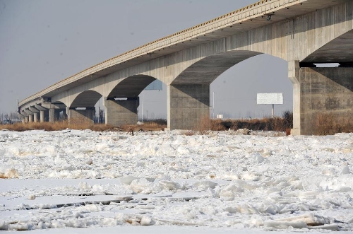
The Yellow River’s water shortage problems indeed exist at its very source on the Qinghai-Tibetan plateau – the decline of water caused by global warming and the melting of Tibetan glaciers could make the situation worse. Wang Yongchen, founder of environmental NGO Green Earth Volunteer, has personally visited the source of the Yellow River in Qinghai. According to Wang, the river’s source has been constantly receding since 2009. “This year the source has receded to over 3.5 meters away from its original geographical landmark,” Wang, recently having returned from her fourth visit to the region in late August, told NewsChina.


Cui Sheng, an environmentalist from Henan Province told NewsChina that desertification caused by permafrost destruction on the Qinghai Plateau is spreading, a significant threat to the existence of a number of great rivers, including the Yellow River. More importantly, the outdated allocation plan, which was originally based on the provincial water consumption requirements of the late 1980s, is no longer applicable to contemporary economic conditions. For example, the status of the Ningxia Hui Autonomous Region and the Inner Mongolia Autonomous Region as agriculture-focused regions meant that the plan set forth in 1999 focused on irrigation water consumption for these two regions. Nowadays, aside from agriculture, the two regions, which contain 800 kilometers of the Yellow River, are currently the two fastest developing regions in the high water-consuming coal-to-chemicals industry. Thus, for the past few years, the two provinces have had to resort to trading water use rights between the mining industry and agriculture in order to meet their needs.
“The plan is outdated,” said Qi Pu, senior engineer from YRCC told NewsChina during a recent phone interview. “The conflicts of interests among different provinces are getting more severe, and it is difficult to resolve them at the moment.”
Pollution
Over the past two decades, numerous fast-developing cities have emerged along the Yellow River, like Wuhai, a resourceful industrial city that developed fast in the middle section of the river. And like most rivers in China, the Yellow River suffers from the scourge of water pollution.
In 2007, YRCC released a water quality survey that graded 33.8 percent of the river system at “level 5” (according to China’s “Environmental Quality Standards for Surface Water”, levels 4 and 5 are classified as having medium or heavy pollution), deeming it unfit for drinking, aquaculture, agriculture or industrial use.
Zhang Qing from Water Resource Protection Bureau of YRCC told NewsChina that in 2006, the central authorities had begun to place more emphasis on pollution control, and that this, together with the water allocation project, had helped to improve the situation. Since 2009, the total length of the river with water quality level 4 and 5 has reduced to 29.4 percent. Despite the effects of pollution control measures, Zhang also admitted that it was difficult for YRCC to monitor individual enterprises and prevent them from releasing pollution into the river.
The most recently reported industrial water pollution issue along the Yellow River concerns a large petrochemical complex in Baotou, Inner Mongolia. The plant, owned by the State-owned Shenhua Group and initially scheduled to begin commercial production in late 2011, is part of a high-profile project to produce polyethylene and polypropylene from coal. Without obtaining the requisite permits to release waste water into the Yellow River from YRCC, the plant has been doing so for the past two years, causing sizeable financial losses for many local fishermen. Following an inspection in June, YRCC issued a notice to the company requiring it to stop operation and make arrangements for the treatment of its waste water.
“We only have the right to manage enterprises that release waste water directly into the mainstream of the Yellow River,” said Zhang Qing, adding that even this limited power, granted by China’s Water Law, is rarely respected by enterprises. “People regard the monitoring of and punishment for river pollution as the responsibility of the environmental department.” Indeed, YRCC only acts as a water quality monitor, once individual pollution is spotted, it is authorized only to raise suggestions to local government or environment departments but has no executive right.
The responsibility of monitoring individual waste water release lies with the department of water resources, while the environmental department deals with management of water pollution – a complicated bureaucratic situation that appears to have posed obstacles for water pollution control along the entire length of the river.
"Similar cases have been identified, and our responsibility is to stop the enterprise from releasing pollution into the Yellow River ‘directly,’” said Zhang. “We are not responsible for its internal management of polluted water treatment.”

To read the whole article: http://www.newschinamag.com/magazine/river-of-constant-sorrow

Wednesday, August 28, 2013

Yellow River - RIVER OF CONSTANT SORROW (Excerpts from News China, Part I)

At 5,464 kilometers in length, the Yellow River contains only two percent of China’s water resources, yet provides water for 12 percent of China’s 1.3 billion population, irrigates 15 percent of its farmland and generates about 14 percent of its GDP. “The Yellow River lacks water resources, and the water supply currently drawn from the river is beyond its capacity,” said Chen Xiaojiang, director of the Yellow River Conservancy Commission (YRCC) of the Ministry of Water Resources in March this year.

The river runs through nine provinces and autonomous regions and empties into the Bohai Bay off the coast of east China’s Shandong Province. For a period in 1972, it failed for the first time to reach the sea, and flow interruptions have regularly been observed since 1987. The annual frequency of “dry days” reached a peak at 226 days for a 704-kilometer section of river in Shandong in 1997. In 1998, the National Development and Reform Commission (formerly the State Development Planning Commission) and the Ministry of Water Resources issued annual water-use quotas and a distribution scheme for the river. These management policies determined total water withdrawals on the basis of hydrology, the need for sediment transport and other ecological factors, and established annual provincial water withdrawals including a seasonal distribution plan for greater withdrawal in the rainy season than in the dry season.

With the authorization of the State Council, YRCC acts as the sole administrator for the allocation of the Yellow River water supply to the nine provinces and autonomous regions through which it flows. In March 1999, the Commission issued the first water withdrawal quota directive and started the water withdrawal control plan for the whole basin. This policy was extended from the main Yellow River to its tributaries in 2006.


According to planning information provided to NewsChina by YRCC, the river's annual water resources that can be tapped is 58 billion cubic meters, and 37 billion cubic meters are allocated to the nine provinces and autonomous regions, with the remaining 21 billion earmarked to wash away silt in the river. The quota for each province and autonomous region is based on their population, economic structure and water demand. A trade in water use rights between various sectors has sprung up in some provinces.

Implementation of these policies has ensured uninterrupted flow of the river to the sea for 14 consecutive years since 2000 and improved the water resource and ecological health of the whole basin. Ecosystem integrity and biological diversity have improved greatly.

Wednesday, July 17, 2013

A Briefing of the Yellow River in China


【Introduction】The Yellow River (or Huang He) is the second-longest river in Asia after the Yangtze and the sixth-longest in the world at the estimated length of 5,464 km (3,395 mi).Originating in the Bayan Har Mountains in Qinghai province of western China, it flows through nine provinces and empties into the Bohai Sea near the city of Dongying in Shandong province. The Yellow River basin has an east--west extent of 1,900 kilometres (1,180 mi) and a north--south extent of 1,100 km (680 mi). Its total basin area is 742,443 square kilometres (286,659 sq mi). The Yellow River is notable for the large amount of silt it carries—1.6 billion tons annually at the point where it descends from the Loess Plateau. If it is running to the sea with sufficient volume, 1.4 billion tons are carried to the sea annually. One estimate gives 34 kilograms of silt per cubic meter as opposed to 10 for the Colorado and 1 for the Nile. This video shows the sediment control projects along the Yellow River.

Sunday, June 9, 2013

Physical Model Experiment for Bank Regulations of the Lower Yellow River

Physical model experiment was carried out for Huayuankou to Jiahetan reach of the Lower Yellow River. This 103 km long reach is famous for being wandering, with strong depositions occurred often. It’s also called “suspended river” above ground. The braided reach is characterized by a distance of 5 to 20 km between the left and right levees, with a channel width of 1.0 to 3.5 km, and a longitudinal channel slope of 1.72% to 2.65%. The elevation difference between the floodplain and the main channel is relatively small, less than 2.0 m in the reach between Huayuankou and Gaocun. 


This reach is generally quite straight with a sinuosity coefficient of 1.15. In addition, the braided reach is composed of many wide and narrow stretches. In a wide stretch with a long stream length, there are numerous sand bars and complicated branches appearing at low water stages. This kind of planform results in flow diverging and frequent shifting of the main streamline. The channel bed is composed of fine sediment, with non-uniform size distribution ranging from 0.002 mm to 0.18 mm.

The physical model uses a horizontal scale of 1:800, vertical scale of 1:60. Fine residual of burnt coal ash from Zhengzhou Thermal Power Plant was used as the model sediment, with dry bulk density of 0.66 ~ 0.68 t/m3, wet bulk density of 2.1 t/m3. The initial condition of bathymetry was chosen as the field measured data in 2002. The inflow condition was provided by Yellow River Engineering Company of YRCC as a 15-year flow-sediment series from multi-year regulation rules of the Xiaolangdi Reservoir. The first five years was the initial operation period for Xiaolangdi Reservoir, only clear water was released to flush the sediment. The last 10 years was the multi-year sediment regulation when sediment was released only at certain right time during flood. In the proposed river training plans, 14 existing dikes will be still used, plus constructing of 250 new dikes. Each dike is around 1000 m long (200m of warping segment), with the top of the dike being 0.5 m higher than the floodplain. The distance between each dike is around 500 m to 800 m. The objective training width of the reach is set to be 600 m in general. At some curvature locations, this value was loosening to be 1000 m for flood protection purposes. 


The physical model results showed that with the regulation of Xiaolangdi Reservoir, around 80%-90% of the sediment can be regulated to be transported when the flow discharges are greater than 2,500 m3/s during flood season, especially for the year with abundant flow and sediment. The sediment transport ratio can be as high as 90% and above for the man-made flood with the construction of dikes.

Sunday, June 2, 2013

Hyperconcentrated Flow in Sanmenxia Reservoir of Yellow River in 1993 (Part II)

After storing water and sediment for several months, Sanmenexia Reservoir in the middle reach of the Yellow River suddenly released water on June 25, 1993. Hyperconcentrated flow was created with a maximum flow discharge at 1,480 m3/s,and the sediment concentration was measured to be 300 kg/m3 for about 24 hours! The water surface elevation dropped from 307.5 m to 294.25 m in the reservoir. This video shows as the  bank collapsed, sand and silt  falling into the water and develop the hyperconcentrated flow. The hyperconcentrated flow form a channel inside reservoir, and then traveled through the spillway to the downstream. You can also hear the hydraulic engineers discussing the how the channel inside the reservoir developed, as well as the hyperconcentrated flow as they took the video of the bank failures.


Thursday, May 2, 2013

Ode to Yellow River (Song in 1975)

Enjoy a song "Ode to Yellow River" by Xinchang Li in 1975 with beautiful scenery of the Yellow River in the upper, middle and lower reaches.


The lyrics are translated as the followings:

Standing on a mountain top, I look at the Yellow River rolling and running towards the southeast.
The stormy billows stirring up lofty high raging waves, 
and the turbid flow forming twist and turn channel. 
It runs from the foot of Kunlun mountain towards the coast of Yellow Sea; 
dividing central China into south and north. 
Ah, the Yellow River! 
You are the cradle of the nation! 
Five thousand years' ancient culture was originated from you; 
and many heroic stories occurred on your side. 
Ah, the Yellow River! 
You are great and strong, like a giant standing on the Asian plain, 
building our nation's protective screen by your heroic body. 
Ah, the Yellow River! 
You flow down miles long, rushing vigorously with thousands of irony arms reaching out toward both the south and north banks. 
The great spirits of our nation will be developed under your feeding. 
The heroic sons and daughters of our homeland will follow your example and 
to be as great as you! 
to be as strong as you!

For information about this song, please see: http://cosmicdinesh.blogspot.com/2012/06/ode-to-yellow-river.html.

Sunday, February 10, 2013

Happy Spring Festival, Year of Snake!


Today it's the first day of the Chinese New Year, year of SNAKE...Please enjoy the Spring Couplet (a pair of poetry) for the new year.

The first line (to your right) : In the old days, due to the flooding of the Yellow River, people have no means to make a living.
The second line (to your left): In nowadays, we have completely harnessed the Yellow River, so people can enjoy a safe and secure life.
The horizontal line (in the middle): Great changes on the Yellow River.


Thursday, January 31, 2013

Yellow River's Main Stream Covered by Floating Ice


 Photo taken on Jan. 21, 2013 shows the ice floating pass a bridge on the Yellow River near Yinchuan, capital of northwest China's Ningxia Hui Autonomous Region. More than 1,022 kilometers of the Yellow River's main stream were covered by floating ice due to the cold weather till Jan. 20. (Xinhua/Peng Zhaozhi)

Photo taken on January 21, 2013 shows the ice floating pass a bridge on the Yellow River near Yinchuan, capital of northwest China's Ningxia Hui Autonomous Region. More than 1,022 kilometers of the Yellow River's main stream were covered by floating ice due to the cold weather till January 20. (Xinhua/Peng Zhaozhi) 


Photo taken on Jan. 21, 2013 shows the ice on the Yellow River near Yinchuan, capital of northwest China's Ningxia Hui Autonomous Region. More than 1,022 kilometers of the Yellow River's main stream were covered by floating ice due to the cold weather till Jan. 20. (Xinhua/Peng Zhaozhi)

Photo taken on January 21, 2013 shows the ice on the Yellow River near Yinchuan, capital of northwest China's Ningxia Hui Autonomous Region. More than 1,022 kilometers of the Yellow River's main stream were covered by floating ice due to the cold weather till January 20. More than 1,022 kilometers of the Yellow River's main stream were covered by floating ice due to the cold weather till January 20. (Xinhua/Peng Zhaozhi) 


Photo taken on Jan. 21, 2013 shows the ice on the Yellow River near Yinchuan, capital of northwest China's Ningxia Hui Autonomous Region. More than 1,022 kilometers of the Yellow River's main stream were covered by floating ice due to the cold weather till Jan. 20. (Xinhua/Peng Zhaozhi)   

Photo taken on January 21, 2013 shows the ice on the Yellow River near Yinchuan, capital of northwest China's Ningxia Hui Autonomous Region. More than 1,022 kilometers of the Yellow River's main stream were covered by floating ice due to the cold weather till January 20. (Xinhua/Peng Zhaozhi)    

Saturday, January 12, 2013

Yellow River Freezes Up

Ice has frozen over the Yellow River in the Inner Mongolia Autonomous Region, covering a length of 680 kilometers, 94 percent of the river section.

This year’s freeze has come five days earlier than in last year. Starting from mid-November, the region’s Baotou City and Tuoxian County section had seen drift ice, or ice rafts, ranging from 20 percent to 30 percent.
As the temperature drops in winter, the ice surface coverage increases, causing the water level to rise. As of Saturday, the ice coverage had reached the boundary between Ningxia Hui Autonomous Region and Inner Mongolia. Local flood prevention departments have set up a 24-hour monitoring system and are high on alert for potential levee breach and flooding risks. 


The Yellow River Conservancy Commission has told local departments to step up patrols along the riverside, watch the weather and ice flows closely so that efficient measures can be adopted in case of new crises.

The Yellow River, the second longest in China, originates in Qinghai Province, northwest China, flows through Gansu Province, Ningxia Hui and Inner Mongolia autonomous regions, Shaanxi, Shanxi, Henan and Shandong provinces before emptying into Bohai Sea.